Photo Record
Images
Additional Images [75]


Metadata
Title |
Lake Pukaki and the Mount Cook National Park |
Description |
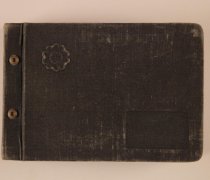
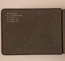
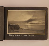
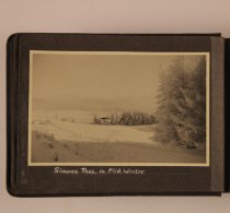
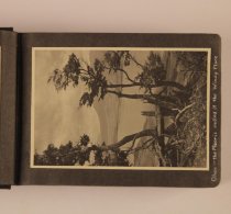
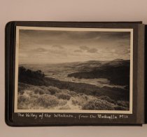
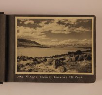
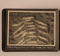
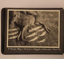
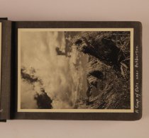
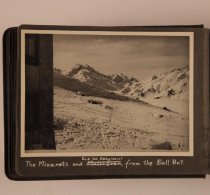
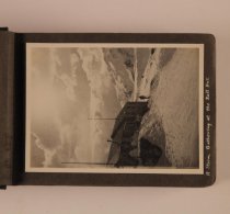
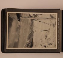
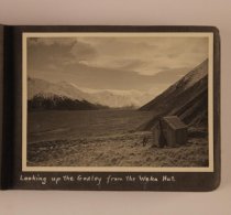
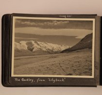
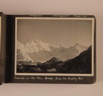
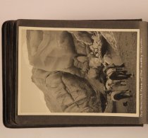
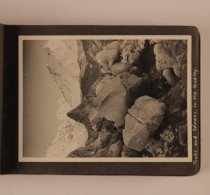
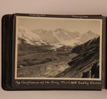
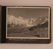
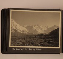
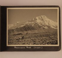
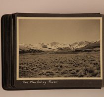
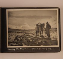
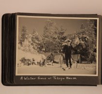
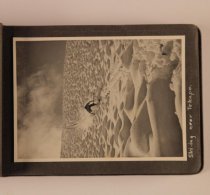
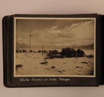
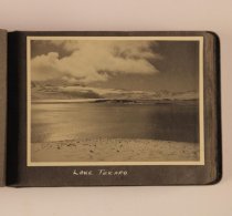
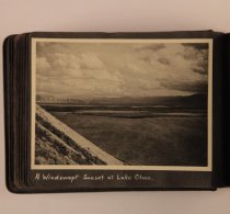
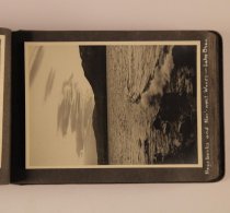
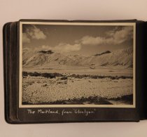
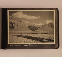
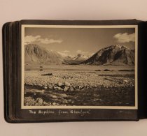
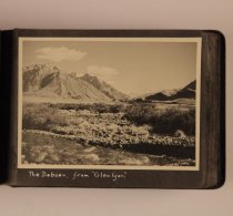
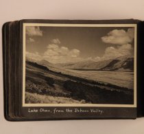
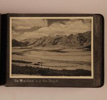
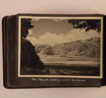
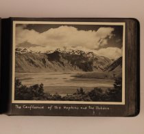
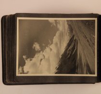
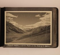
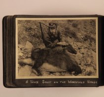
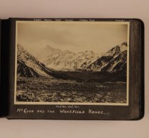
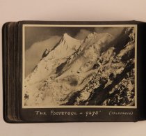
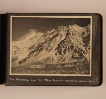
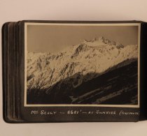
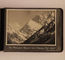
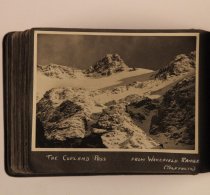
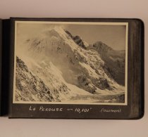
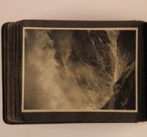
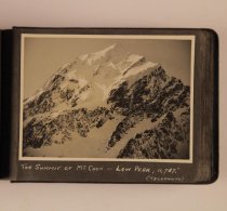
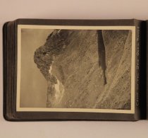
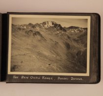
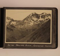
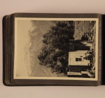
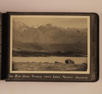
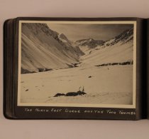
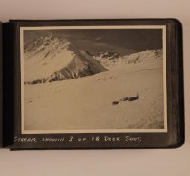
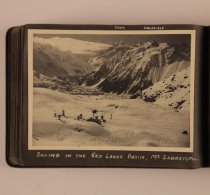
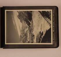
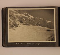
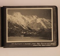
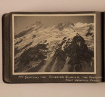
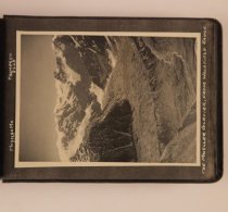
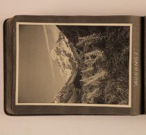
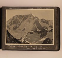
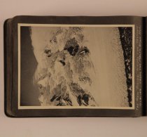
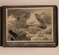
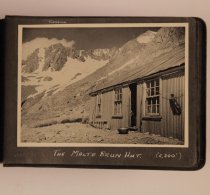
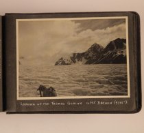
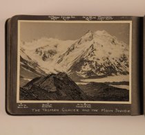
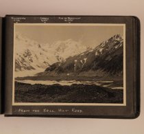
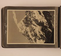
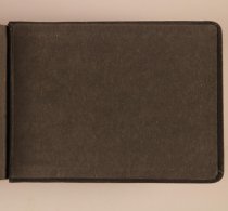
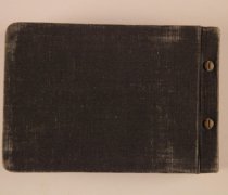
An undated black cloth-covered album of scenes around Lake Pukaki and the Mount Cook National Park, circa 1950? The album belonged to "N.Z.421883 Sgt C.R. Anderson, R.N.Z.A.F. 10 Sealey St., Timaru, N.Z." (as labelled in white ink inside front cover). It is comprised of black and white images mounted on black paper pages bound with a post-and-screw system. The images (numbered sequentially) are entitled as follows: #05 - A foggy sunrise at Lake Pukaki #06 - Simon's Pass, in mid-winter #07 - Ohau - the Maoris called it the Windy Place #08 - The valley of the Whakaea, from the Umbrella Mts #09 - Lake Pukaki, looking towards Mt Cook #10 - A good bag of trout, up to four pounds, from Waikaia #11 - Two six pounders, from the whakaea, at Gow's Creek #12 - A mixed bag - trout from A[rgyle?], a fawn from Piano Flat #13 - A crop of oats, near Ashburton #14 - The Minarets and Elie de Beaumont from the Ball Hut [NB: Elie de Beaumont above a crossed out Malte Brun] #15 - A storm gathering at the Ball Hut #16 - Down the Tasman from the Ball Hut #17 - Looking up the Godley from the weka Hut #18 - The Godley, from "Lilybank" (also notes the Conrad 8,551') #19 - Sunrise on the main divide, from Godley hut (also notes the Frances 7876', the Sutton turner 8300' and Wolseley 8438') #20 - The terminal face of the Godley Glacier #21 - Peaks and Seracs, in the Godley #22 - The confluence of the Grey, Maud and Godley Glaciers (also notes the Loughnan 8495' and Jacqueline Pass) #23 - The Classen Glacier and morraine ((also notes the Huss 8165) #24 - The head of the Godley River #25 - Panorama Peak (6,930') #26 - The Macauley River #27 - Leaving the MacAuley after a shooting trip #28 - A winter scene at Takapo House #29 - Skiing near Tekapo #30 - Winter sunrise at Lake Tekapo #31 - Lake Tekapo #32 - A windswept sunset at Lake Ohau #33 - Hogsbacks and Nor'-west waves - Lake Ohau #34 - The Maitland, from "Glenlyon" #35 - The Temple, from "Glenlyon" #36 - The Hopkins, from "Glenlyon" #37 - The Dobson, from "Glenlyon" #38 - Lake Ohau, from the Dobson Valley #39 - The Maitland and the Temple #40 - The Temple, looking across the Dobson #41 - The confluence of the Hopkins and the Dobson #42 - The Dobson River valley #43 - Mount Sefton, and the peaks at the head of the Dobson #44 - A Thar shot on the Wakefield range #45 - Mt Cook and the Wakefield Range [The locations of Cook, Nazomi, Pibrac, Turner, Mabel, Rosa, Kinsey, Proud Pass and Ball Pass identified near the edge of the print] #46 - The Footstool - 9073' (Telephoto) #47 - The Footstool and the Main Divide - Showing Hooker Hut [a small marker along the bottom edge of the print marks the location of the Hooker Hut] #48 - Mt Sealy - 8651' - At Sunrise (Telephoto) #49 - The Mueller Valley and Maunga Ma - 8335' (Telephoto) #50 - The Copland Pass from Wakefield Range (Telephoto) #51 - La Perouse - 10,001' (Telephoto) #52 - A Storm clearing off Mount Cook #53 - The Summit of Mt. Cook - Low Peak, 11,787' (Telephoto) #54 - Camp on the Ben Ohau Range #55 - The Ben Ohau Range, Pukaki Downs #56 - The Ben Ohau Range #57 - In the Neutral Block, Glenlyon (Telephoto) #58 - Pukaki Downs Back Mustering Hut #59 - The Ben Ohau Range from Lake Pukaki (Telephoto) #60 - The North East Gorge and the Two Thumbs #61 - Stream, showing 3 of 18 deer shot #62 - Ski-ing in the Red Lakes Basin, Mt Sebastopol #63 - The Hooker, Main Divide and Mount Cook #64 - The Ball Hut - 3693' #65 - Mt Sefton - 10, 359', and The Footstool 9073, from the Hermitage #66 - Mt Sefton; The Stocking Glacier; the Footstool, from Wakefield Range #67 - The Mueller Glacier, from Wakefield Range [the location and height of Maunga Ma 8335 and Thompson 8648' are marked along the upper edge of the print] #68 - "Aorangi" #69 - Mt Cook - High Peak, 12,349' (Telephoto) from Malte Brun Hut [the location and heights of various peaks are indicated along the upper edge of the print; 11,787, 12,173, 12,349, Green Sad[dle] & Linda Gl[acier], Dampier 11,287'] #70 - The Main Divide across the Tasman Glacier, from the Malte Brun Hut #71 - De La Beche (9,817') (Right) (Telephoto) [additional writing has been crossed out and is illegible] #72 - Looking up the Tasman Glacier, from Malte Brun Hut #73 - The Malte Brun Hut (6,300') #74 - A Moulin in the Hochstetter Ice, Tasman Glacier #75 - Looking up the Tasman Glacier to Mt Darwin (9715') #76 - The Tasman Glacier and the Main Divide [several peaks and areas of interest are marked around the edge of the print; Mt Rudolf 9059', Graham Sad[dle] 8759', De La Beche 9817', Minarets 10,022: 10,058, Road to Ball Hut, Rudolf Glacier, De La Beche Corner & Hut. #77 - From the Ball Hutt Road [along the top edge of the print are noted the location and heights of several peaks; Goldsmith 9532', Green 9305', Elie de Beaumont 10,200'] #78 - Mt Cook, from near the Hermitage [the height of three unidentified peaks are noted along the top of the print; 12,349', 11787', 12,173'] |
Photographer |
Anderson, Cecil R |
Year Range from |
1940 |
Year Range to |
1960 |
Place |
Aoraki Mount Cook, N.Z. |
Format |
Album, Photograph |
Medium |
Cardboard/Paper/Paper, Photographic/Metal/Fabric |
Processing Method |
silver gelatin print |
Print Size |
100 x 160 mm (approx) |
Dimension Details |
Album comprised of photographs mounted on black paper pages, total size 145(h) x 210(w) mm. Bound with twin posts and screws. |
Original/Copy |
Original |
Search Terms |
Lake Pukaki, Canterbury Simons Pass, Canterbury Ohau River, Canterbury Minarets (hill), West Coast Mount Elie de Beaumont, West Coast Ball Hut, Canterbury Tasman Glacier, Canterbury Godley River, Canterbury Godley Hut, Canterbury Mount Conrad, Canterbury Godley Glacier, Canterbury Mount Frances, Canterbury Mount Sutton-Turner, West Coast Mount Wolseley, Canterbury Grey Glacier, Canterbury Maud Glacier, Canterbury Mount Loughnan, Canterbury Jacqueline Col (pass), Canterbury |
Subjects |
Photograph albums Landscape photographs Mountains |
Catalogue Number |
2008/131.01 |